After a while I can’t load any new maps (app goes blank, shuts down, or throws an error while trying to load maps)
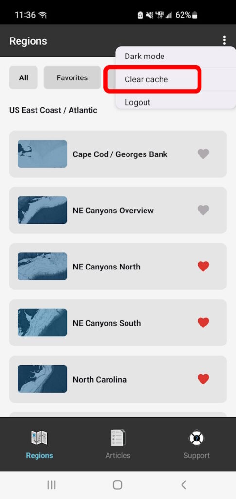
Try clearing out old map data using the “Clear cache” button in the … menu in the top right corner of the Charts list.
To support offline use, the app downloads and caches maps and layer images to your device. Over time these map images begin to take up storage space, which can prevent new maps from loading up. The “Clear cache” button will clear out the old map images and allow the app to load regions again without crashing or throwing an error.

How often should I clear cache?
In general, we recommend clearing cache after 3-5 days of regular usage, or sooner if you find that the app crashes or throws an error when loading up maps on a regular basis. It’s also a good idea to clear cache if you haven’t used the app in a while, since any saved map layers like SST and Chlorophyll will be old by then and not very useful anymore.
How often you need to clear cache largely depends on your specific phone/tablet’s available storage and RAM memory, as well as which region(s) you use most. For example, you may need to clear cache more often if you use larger regions like the Gulf of Mexico Overview region, but not as often for smaller regions like Los Cabos or Loreto / La Paz.
We also recommend that you only clear the cache at home or in an area with strong, reliable cell/data service coverage to be able to download fresh maps. We even hide the “Clear Cache” button when your phone is offline so that you don’t accidentally delete saved maps when you’re offshore and can’t re-download them.
I got a message saying “This map has been updated, would you like to reload?” What does that mean and which option should I choose?
This message means that since the last time you viewed this region, there are newer map layers available than what you have saved to your device. You can either “update” to refresh the map completely with all the new map layers, or “cancel” to continue using what you already have saved on your device.
If you’re in an area with strong, reliable data signal (such as your home, office, or marina), you can choose “update” to get the latest map updates. They’ll load up quickly and you’ll have the latest info ready to go.
If you’re offshore or in a spotty/poor coverage area when you get this message, we recommend you choose “cancel.” You’ll still have all the maps you had previously loaded up, and you won’t risk losing the map entirely if data service cuts out before everything gets re-downloaded.
How does the app work offshore? Don’t I need wifi or cell service to use it?
We specifically built the mobile app for use offshore and out of range of cell or data service. Simply load up your region and any layers you want to use while you’re at the dock or marina with data access, and all the layers you view will automatically save to your device for offline use even if you lose cell/data service! Learn more about the mobile app here
How do I show my current location on the chart?
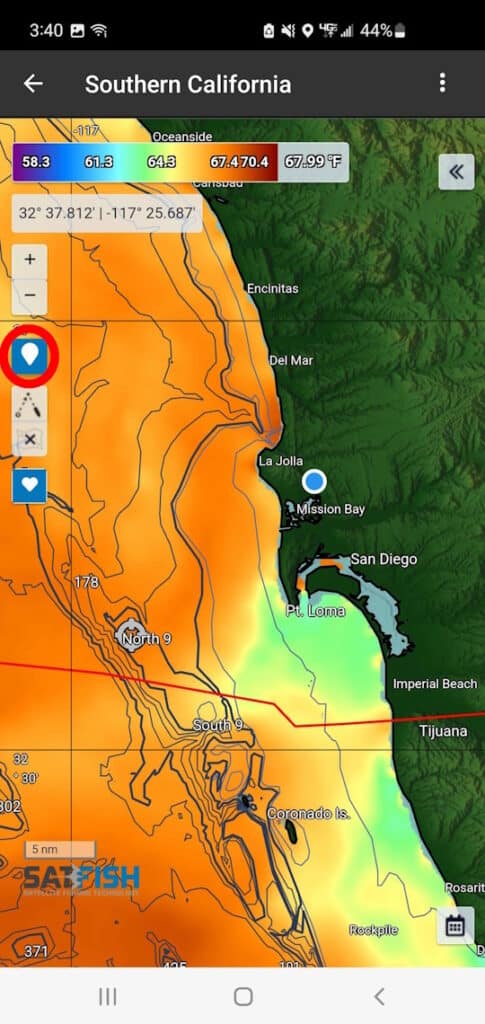
You can see your current location on the chart by using the balloon icon on the left side of the map window. This activates your device’s built-in GPS positioning service to show your location.

Many devices have offline-capable GPS positioning, allowing you to see your location even when you’re offshore and out of cell service range. However, a few devices (some iPad models and other tablets) rely on wifi-based GPS, which is only available online. Please check your specific device specifications for more info.


