Baja Overview
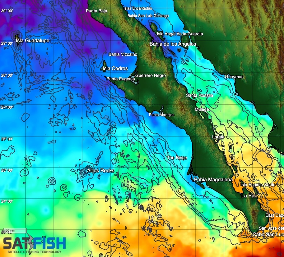
SatFish’s Baja Overview fishing map covers the entire peninsula and Sea of Cortez. This is a great map to get a big-picture overview of water temperature and color up and down the peninsula and track marlin, bluefin tuna, yellowfin tuna, dorado, and wahoo on their seasonal migrations. It’s also a great resource to help you plan your next Baja road trip for fishing, diving, and spearfishing.
Baja – Pacific North
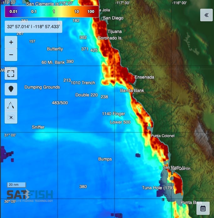
The Baja North Pacific map shows the major fishing ports of Ensenada and San Quintin, and covers the Coronado Islands, Punta Colonet, San Martin Island, Punta Baja, San Geronimo Island, and Sacramento Reef. This is the go-to map for SoCal anglers during spring and summer months as bluefin tuna, yellowfin, and dorado work their way up the coast into local waters, and for Ensenada and San Quintin locals to know when and where to target yellowtail and white seabass.
Baja – Pacific Central
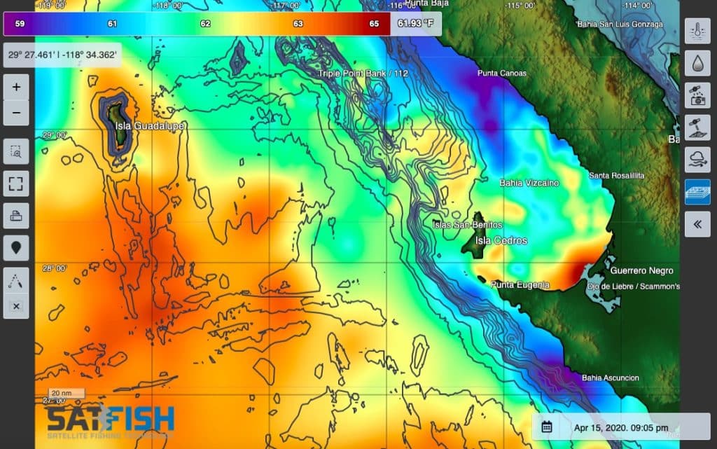
The Baja Pacific Central map covers the central Baja region known for giant yellowtail and great tuna and dorado fishing. The map displays Guadalupe Island down to Asuncion and includes Bahia Vizcaino, Cedros Island, Benitos, and Bahia Tortugas.
Baja – Pacific South
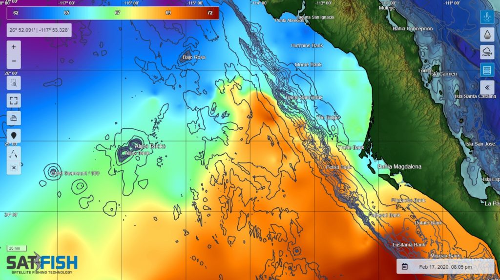
The Baja Pacific South map displays Abreojos to the Lower Banks, including Alijos Rocks and the legendary striped marlin grounds off Magdalena Bay like the Ridge and Thetis Bank. SatFish’s SST and chlorophyll maps will help you decide if you should head north, south, or straight west from the anchorage for a shot at a triple-digit day.
Los Cabos / East Cape
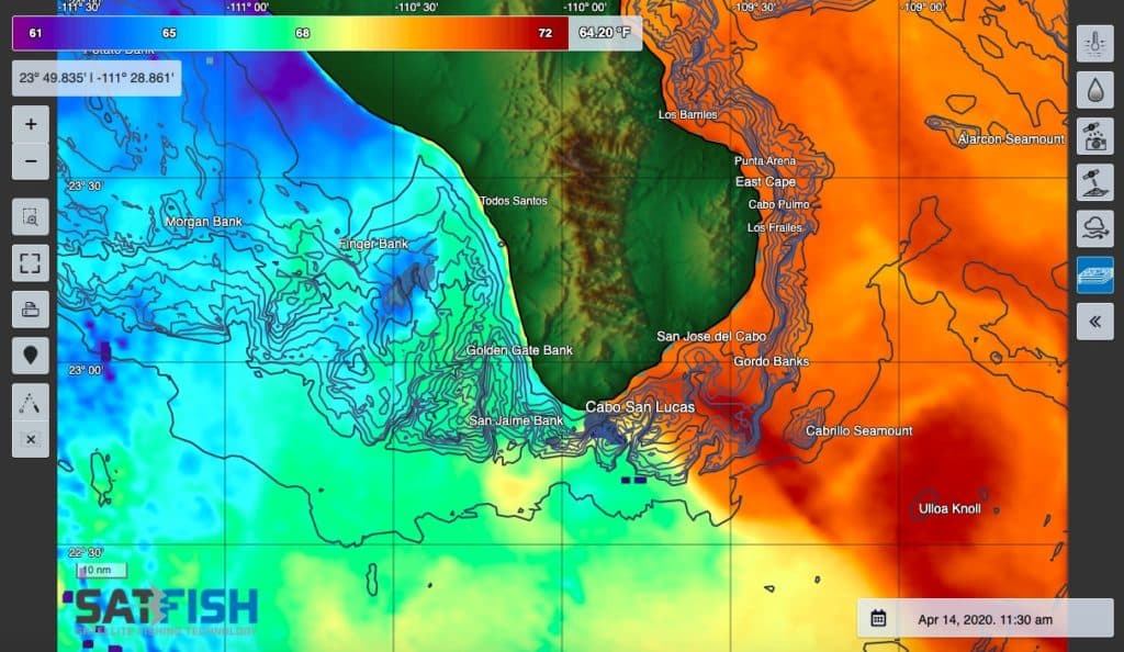
SatFish’s Los Cabos / East Cape map covers the premier offshore fishing destination of Cabo San Lucas, San Jose del Cabo, and Marina Los Cabos, with its world-class fishing and multi-million dollar billfish tournaments. The map also shows the beloved East Cape region, known for world-class fishing in a much more laid-back, “authentic” Baja style.
Cortez – San Felipe / Bahia Gonzaga
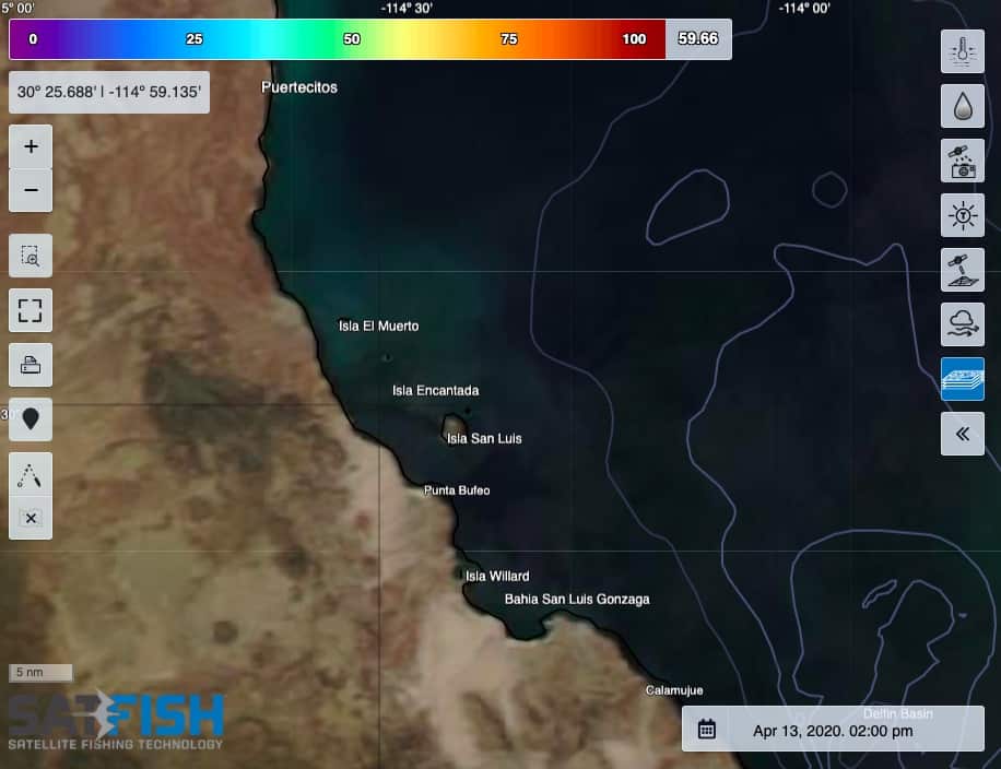
This map covers the northern part of the Sea of Cortez, including San Felipe, Puerto Penasco, Islas Encantadas, and Bahia Gonzaga. This area is well-known for quick weekend getaways for California and Arizona anglers and divers who rely on up-to-date water temperature, water color, true color satellite imagery, and wind maps to find the best conditions and maximize their angling and diving trips.
Baja Cortez – Bahia de Los Angeles
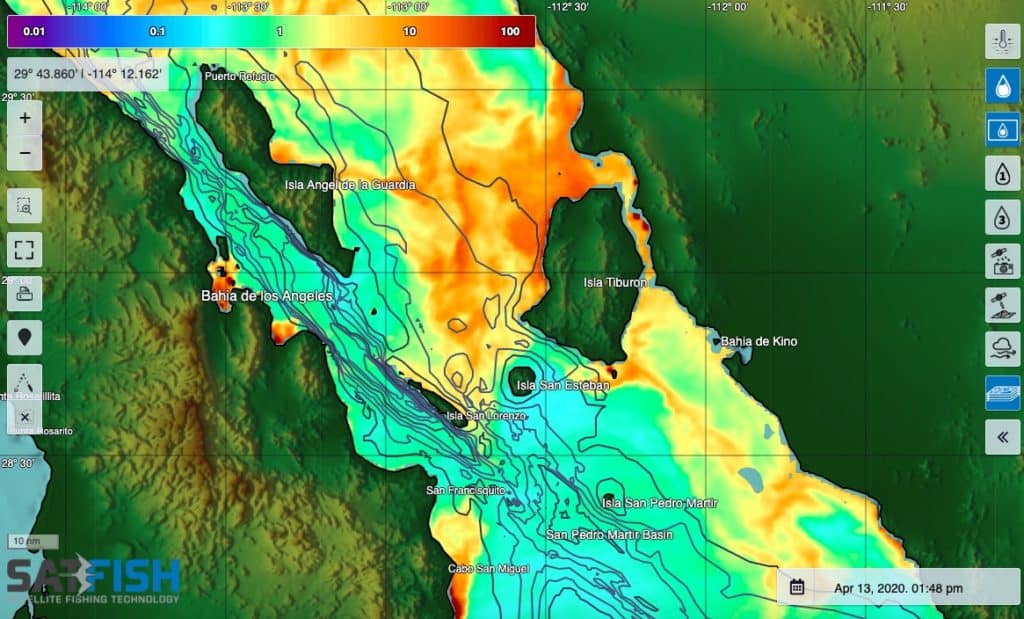
The Bahia de Los Angeles area, including Angel de la Guardia and the Midriff Islands, has fantastic fishing opportunities for yellowtail, cabrilla, grouper, and snapper. Keep an eye on SatFish’s water temperature and color maps in the summer when warm water pushes in to know when and where to find dorado and swim with whale sharks.
Baja Cortez – Santa Rosalia / Mulege
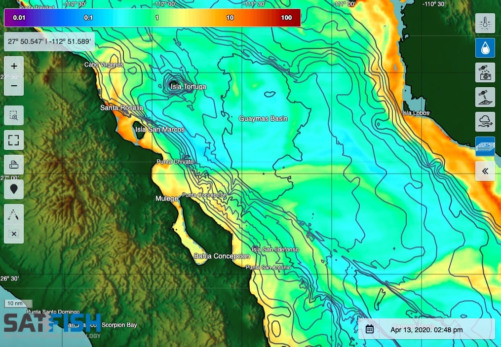
This section of the Sea of Cortez offers great yellowtail, grouper, pargo, and billfish fishing around Santa Rosalia, Isla San Marcos and Isla Tortugas, Mulege, Bahia Concepcion, and the San Carlos / Guaymas area. SatFish’s SST, chlorophyll, true color, and wind maps will keep you dialed in all year round.
Baja Cortez – Loreto / La Paz
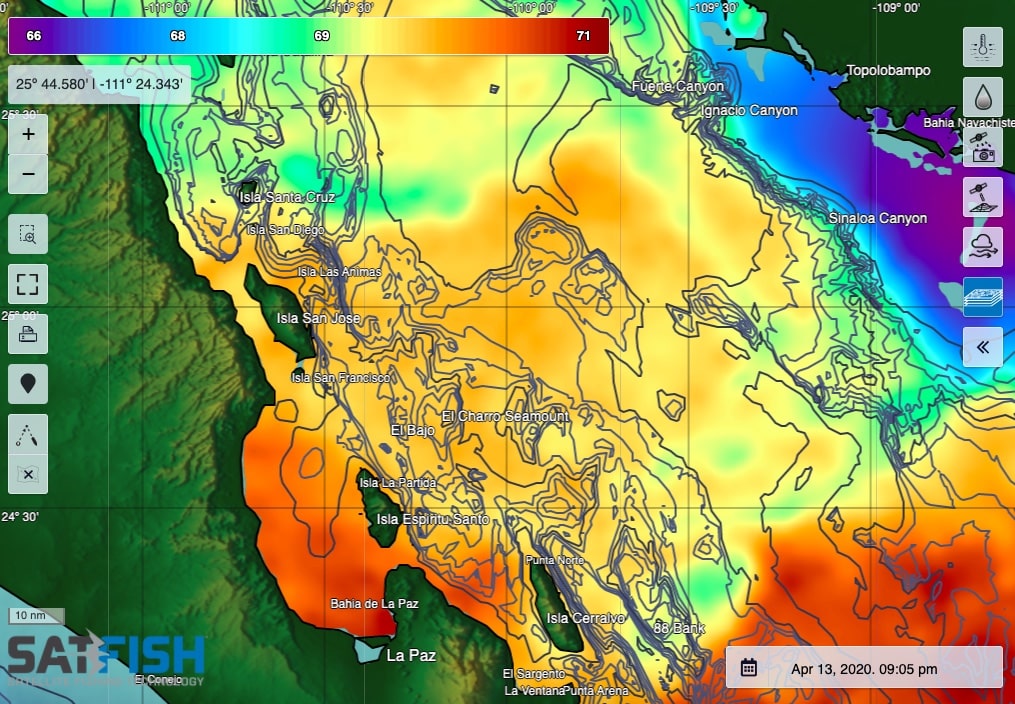
The southern part of the Sea of Cortez, including the islands off Loreto, La Paz, Isla Cerralvo, and Topolobampo on the mainland side, hold great numbers of dorado, wahoo, marlin, and some surprisingly big yellowfin tuna. SatFish’s SST and water color charts will help you find the breaks and edges holding life and gamefish as they push into the islands and over offshore high spots.
